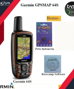
Harga lebih murah dibandingkan dengan yang lain
Garansi Resmi TAM 2 Tahun
Free Memory 8 GB
Map lengkap
Free BirdsEye Satellite Imagery selama 1 tahun
Free Peta Indonesia + basecamp Software
BARANG BARU, BUKAN 2nd, BUKAN REFURBISHED, BUKAN RECONDITION
Sudah berbahasa Indonesia
Kokoh, GPS handheld dengan fungsi lebih, bisa menangkap Glonass dan dilengkapi koneksi wireless
> Layar berwarna berukuran 2,6" yang dapat terlihat di bawah sinar matahari
> Penerima GPS/GLonASS bersensitivitas tinggi dengan antena quad helix
> Free 1 tahun berlangganan BirdsEye Satellite Imagery
> Kompas 3-axis dengan akselerometer, barometrik altimeter
> Konektivitas nirkabel melalui teknologi Bluetooth®¹ atau ANT+™
GPS Garmin Map 64 S merupakan pengembangan terbaru dari GPS Map 62S, sudah ready GLonASS dan built in memory sampai 4 GB.
Physical & Performance:
Physical dimensions 2.4" x 6.3" x 1.4" (6.1 x 16.0 x 3.6 cm)
Display size, WxH 1.43" x 2.15" (3.6 x 5.5 cm); 2.6" diag (6.6 cm)
Display resolution, WxH 160 x 240 pixels
Display type transflective, 65-K color TFT, transflective
Weight 9.2 oz (260.1 g) with batteries
Battery 2 AA batteries (not included); NiMH or Lithium recommended
Battery life 16 hours
Water rating IPX7
Floats No
High-sensitivity receiver Yes
Interface high-speed USB and NMEA 0183 compatible
Maps & Memory:
basemap Yes
Preloaded maps no
Ability to add maps Yes
Built-in memory 4GB
Accepts data cards microSD card (not included)
Waypoints/favorites/locations 5000
Routes 200
Track log 10,000 points, 200 saved tracks
Features & Benefits:
Automatic routing (turn by turn routing on roads) Yes (with optional mapping for detailed roads)
Electronic compass Yes (tilt-compensated 3-axis)
Touchscreen No
Barometric altimeter Yes
Camera no
Geocaching-friendly Yes (Paperless)
Custom maps compatible Yes
Photo navigation (navigate to geotagged photos) Yes
Hunt/fish calendar Yes
Sun and moon information Yes
Tide tables Yes (with optional Bluechart)
Area calculation Yes
Custom POIs (ability to add additional points of interest) Yes
Unit-to-unit transfer (shares data wireless
PLAZA GPS Juga Menyediakan :
- Training Drone For Mapping
- Training GPS Geodetic, Total Station, GPS Marine, dll
- Service Drone, Total Station, GPS
- Kalibrasi Total Station, Waterpass, Theodolite dll
- Menyewakan Total Station, GPS geodetic, dan alat survey lainnya
GPS GARMIN GPSMAP 64s
Harga :
Rp. 4.700.000 / Unit
Merk :
Garmin
Pembelian Minimal :
1 Unit
Pembelian Maksimal :
1 Unit
Pengiriman :
3 hari sejak pembayaran
Lokasi :
Banten - Tangerang Selatan
Dilihat :
16 Kali
Update Terakhir :
18-11-2021 14:38

